Stays in Garafía
Start-area overnight
Town accommodation search on La Palma; choose dates and check availability before booking.
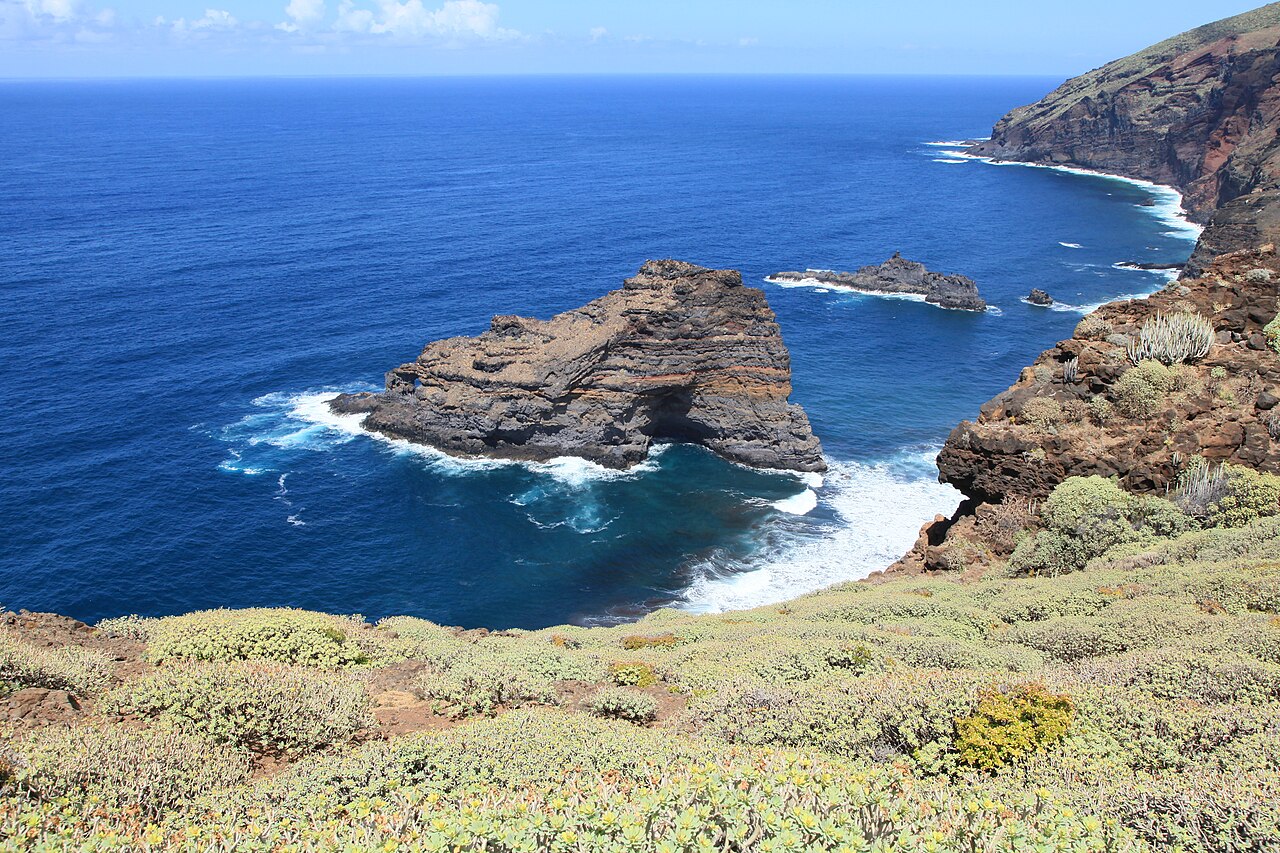
The complete western Camino Real stage links Garafía, Puntagorda and Tijarafe through cultivated slopes, ravines and Atlantic-facing country paths.
Trail essentials
An invitation
Take the signed path at your own pace. Leave room for the landscape, and return with nothing left behind.
The complete western Camino Real stage links Garafía, Puntagorda and Tijarafe through cultivated slopes, ravines and Atlantic-facing country paths.
The path, fully held
Real OSM tiles, real trail anchors, true summit elevations. Save the tiles offline once — walk free of signal.
Soul Signature
Best for wild ground and gentle access — just know that the views are quieter than the effort.
You get a way in that costs the ground almost nothing; the cost is that 10 hours and 2274 m of climbing rule out small legs.
At its best in the hour before nine, the shoulder months, either side of high season.
How deeply the walk stays with you. Memorable from first step to last — worth travelling for.
Stays with people longer than only 0% of the 236 walks we've measured.
How quiet the trail feels — crowds, traffic noise, remoteness. Calm outside peak hours; start before 9am for near-solitude.
Quieter than only 6% of the 236 walks we've measured.
Wild ground and low-impact access — how gently you can arrive and walk. Reachable car-free and walked on resilient ground. Leave nothing.
Gentler on the ground than 42% of the 236 walks we've measured.
Views, water, light and variety along the way. Big, generous scenery with several true stopping points.
More generous to look at than only 1% of the 236 walks we've measured.
The verdict
Worth the journey
Give it 10 h and start early; the quiet is the point, and it does not survive midday.
Who this walk suits
Every dimension is measured from the route's real GPX shape — distance, ascent and time on foot — then ranked against the whole PureSoul library, and read the same way on hiking, walking and running. The chips under each bar are the raw inputs, so you can check the number yourself. Nothing here is sponsored.
Live from OpenStreetMap
Points within 1.5 km of the emerald ribbon, sourced live from the OSM community and cached for 30 days so they still appear when you're offline in the field.
Loading…
Loading…
Loading…
Loading…
Practical notes
Start: Santo Domingo de Garafía. Finish: Tijarafe. This is the complete one-way GR 130 · stage 4; the GPX does not include a vehicle return. A long route with accumulated climbing. The official guide suggests an overnight stop in Puntagorda if you prefer two days. Use caution on occasional road stretches. Check bus connections and carry water for the whole stage.
Official track: https://www.senderosdelapalma.es/en/footpaths/list-of-footpaths/long-distance-footpaths/gr-130-stage-4/ . Listed open when checked on 24 October 2026; this is not a live safety clearance. Check the official closure notices and weather again before walking. Hiking is permitted only where current signs and restrictions allow it.
Distance and climbing are measured from the same stored official line used by the map and GPX. Elevation is sampled from the public terrain elevation dataset (AWS Terrain Tiles, approximately 30 m), replacing noisy source heights without changing the horizontal trail. Walking time is a conservative planning estimate; allow extra time for rests and conditions.
Regional photograph: Atlantic rock formations and coastal slopes near Puerto de Garafía on La Palma; not a photograph of every metre of this route. Soul Signature is a planning score, not a visitor rating or safety assessment.
Where to sleep
Trail-close and calm — for walkers, friends, and families where the trail allows. Along Santo Domingo de Garafía → Tijarafe.
Hotels
Start-area overnight
Town accommodation search on La Palma; choose dates and check availability before booking.
Optional overnight partway along the stage
Town accommodation search on La Palma; choose dates and check availability before booking.
Finish-town overnight
Town accommodation search on La Palma; choose dates and check availability before booking.
Quiet, trail-close places to rest. Always check current availability and conditions. Where we have no page for a specific house, the Booking.com button opens a search for that overnight town — labelled as such, never dressed up as a booked bed. Booking links may earn us a small commission at no cost to you.
Walk prepared
Tell us what the path looks like — mud, snow, a washed-out bridge — or show a photo. You'll get plain hazard notes and a short packing list. Preparation guidance only, never turn-by-turn navigation.
For the path
The full route as a single GPX, plus offline OSM tiles for the whole area. Walk freely, even when the signal forgets you.
Honouring the photographers
More in La Palma
Xymove · terrain map
LiveSpiritedTrail field guide
Tap any pin for hours, water & food details.
Soul & Serenity · how this path is felt
A grounded, regenerative walk. Move gently and it will meet you halfway.
Walked, sat with, scored honestly — strongest in nature.
Presence
89/100
How easily the mind quiets here
Nature
91/100
Wildness, water, light, living silence
Regeneration
85/100
What the body & nervous system bring home
Solitude
81/100
Space from crowds, kindly shared with locals
Take the path with you — full GPX track & offline map tiles for the whole route.
.gpx into Garmin Connect, Komoot, Strava, AllTrails or Gaia GPS — same file works everywhere.